Perhentian Islands Map

Explore the Perhentian Islands map to find beaches, resorts, and travel routes for your island adventure.

Home / Map

Let's Explore Perhentian Island

At Perhentian Islands, every path leads to a new adventure. Use our detailed island map to plan your journey — from scenic beaches and snorkeling spots to cozy resorts and local attractions. Whether you’re exploring by foot or boat, our guide helps you discover the hidden gems of both Perhentian Besar and Perhentian Kecil.

Interactive Island Navigation

Find beaches, dive sites, and resorts with our map — every spot is clearly marked to guide your adventure.

Top Spots & Attractions

Discover coral gardens, trails, and seaside restaurants with our map of must-visit spots.

Travel Routes & Transfers

View jetty points, taxi routes, and paths to plan your island travel easily.

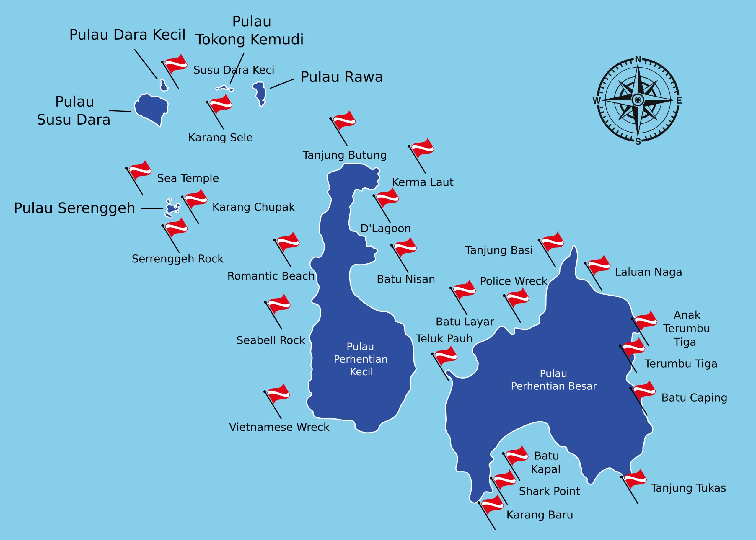
Dive Sites Map of Perhentian Islands

Before you dive, learn how to protect marine life with our sustainable travel guide.
Explore the map below to discover the best diving spots around Perhentian Besar and Perhentian Kecil. Popular sites include Tukar D’Rama, Shark Point, Sugar Wreck, Teluk Keke, and D’Lagoon Reef — each offering a unique underwater experience with varying depths, coral types, and marine encounters. Use the map to plan your dives and find nearby dive centers or boat access points for a seamless adventure.
Marine protected areas have strict rules to preserve coral reefs and marine life. For official marine park regulations, visit the Marine Parks of Malaysia website.


Diving conditions vary by season, with calm seas and best visibility from March to October. Planning your trip? Check the best months for diving in our Perhentian Islands weather guide.
Coral reefs in Perhentian face threats from climate change, anchor damage, and chemical sunscreens. Learn more about coral reef conservation from Perhentian Marine Research Station.